Hiking Trail
Route profile
Notice
In the tour planner we inform you under the tab "Current info" about temporary route changes, closures and detours.
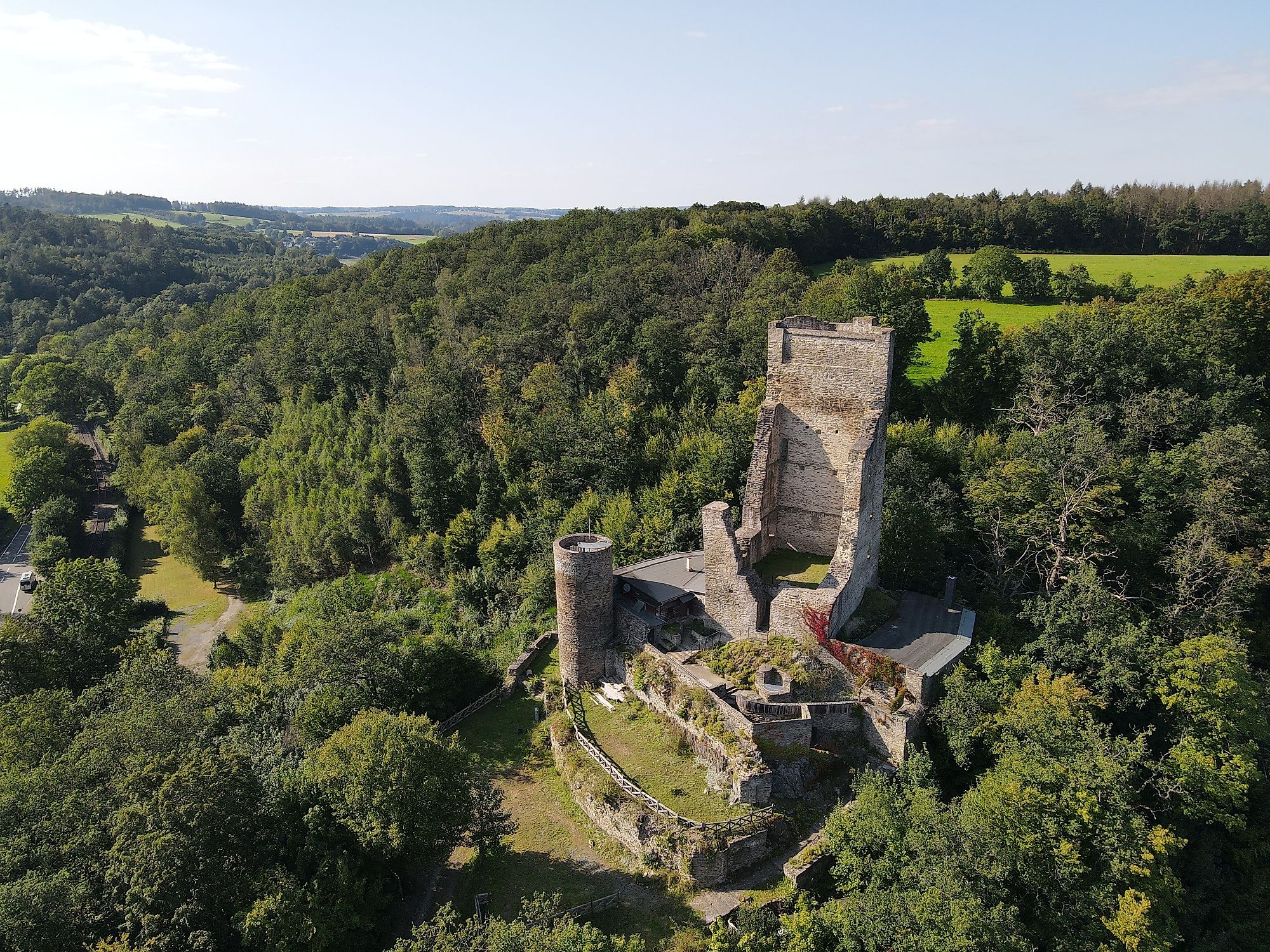
To the Tour PlanerFrom the starting point, the three castle trails (1+2+3) still run together. The Burgweg leads uphill from here in the direction of Steimel. Once in Steimel, the trail passes "Haus Neitzert", where artworks by Karl Bruchhäuser can be viewed (www.bruchhaeser-stiftung.de). The trail continues via the market square, where the nationally renowned Steimel potato market takes place in autumn. From there, the trail continues through the forest in the direction of Reichenstein. The path leads directly past the ruins of Reichenstein Castle. The ruins can be visited by prior arrangement (www.burgruine-reichenstein.de). The castle paths 2+3 lead uphill in Reichenstein towards the district road between Dürrholz and Döttesfeld. After crossing the district road, the trail descends into the idyllic Werlenbach valley. Here the two paths separate. Burgweg 3 leads from the Werlenbach valley directly into the renaturalised Grenzbach valley. In addition to great scenery, far away from vehicle traffic, you can observe the Heck cattle grazing here. The path climbs gently to Linkenbach. After a short, steep ascent, you can again catch great views of the region in the open field. After a further stretch through the forest, you can enjoy more distant views before joining Burgweg 2, which then leads back together towards the starting point in Puderbach. The Burgweg 3 has a length of approx. 20.5 km.
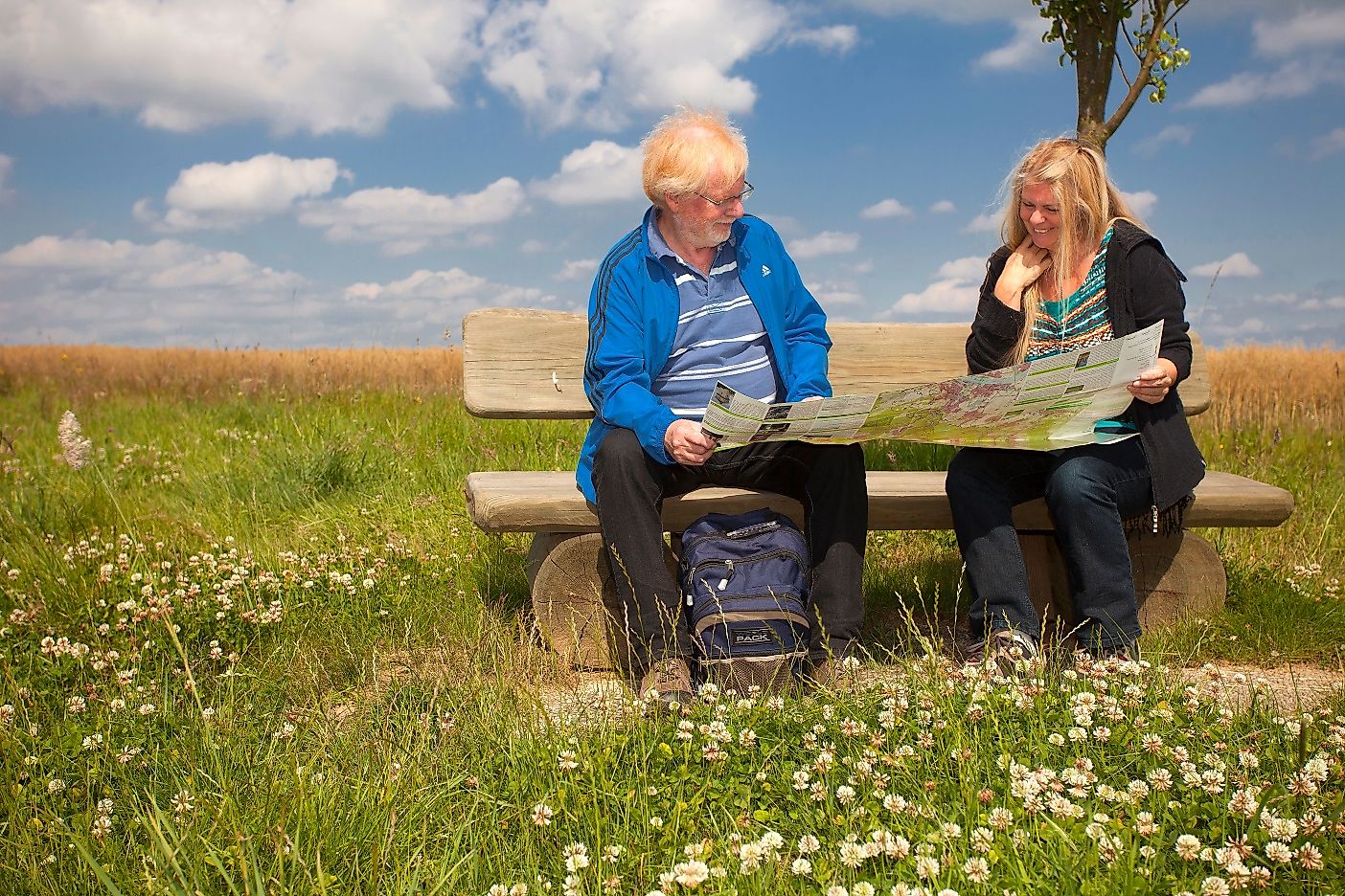
The castle trails 1 - 3 lead you along the most beautiful paths around the Reichenstein castle ruins in Puderbach. A wide variety of activities are offered at the edge of the paths, waiting for you to explore.
The municipality of Puderbach is located in the north-east of the district of Neuwied, directly in the heart of the Westerwald in Rhineland-Palatinate. The ICE railway stations Montabaur and Siegburg/Bonn can also be reached in a short time via the A3.You can reach the Puderbacher Land by taking exit 36 - Neuwied on the A 3 motorway and following the signs to "Puderbach".
fahrplan-bus-bahn.de/rheinland-pfalz/puderbach
We recommend Puderbach as your starting point, as all three trails converge here. We always start our route descriptions from the car park at the school bridge in Barentoner Straße in Puderbach. As the routes are signposted in opposite directions, the route can of course also be walked the other way round.Car park:Barentoner Straße 11, 56305 Puderbach
From the starting point, the three castle trails (1+2+3) still run together. The Burgweg leads uphill from here in the direction of Steimel. Once in Steimel, the trail passes "Haus Neitzert", where artworks by Karl Bruchhäuser can be viewed (www.bruchhaeser-stiftung.de). The trail continues via the market square, where the nationally renowned Steimel potato market takes place in autumn. From there, the trail continues through the forest in the direction of Reichenstein. The path leads directly past the ruins of Reichenstein Castle. The ruins can be visited by prior arrangement (www.burgruine-reichenstein.de). The castle paths 2+3 lead uphill in Reichenstein towards the district road between Dürrholz and Döttesfeld. After crossing the district road, the trail descends into the idyllic Werlenbach valley. Here the two paths separate. Burgweg 3 leads from the Werlenbach valley directly into the renaturalised Grenzbach valley. In addition to great scenery, far away from vehicle traffic, you can observe the Heck cattle grazing here. The path climbs gently to Linkenbach. After a short, steep ascent, you can again catch great views of the region in the open field. After a further stretch through the forest, you can enjoy more distant views before joining Burgweg 2, which then leads back together towards the starting point in Puderbach. The Burgweg 3 has a length of approx. 20.5 km.
Walking shoes and clothing suitable for the weather are an advantage.
The castle ruins in Reichenstein can be visited by arrangement.
puderbacher-land.de/produkt/radwanderkarte-puderbacher-land/
Barentoner Straße 11, 56305 Puderbach
Barentoner Straße 11, 56305 Puderbach
More information & GPX download
Notice
In the tour planner we inform you under the tab "Current info" about temporary route changes, closures and detours.
To the Tour Planer