Long Distance Hiking
Route profile
Notice
In the tour planner we inform you under the tab "Current info" about temporary route changes, closures and detours.
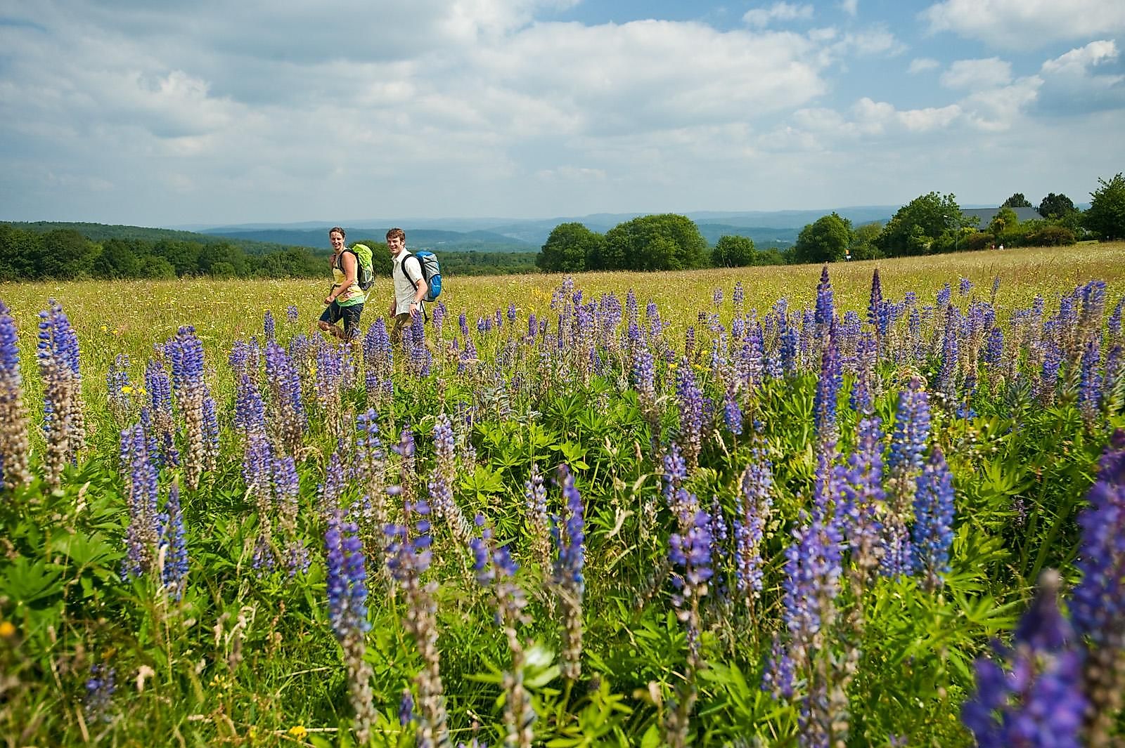
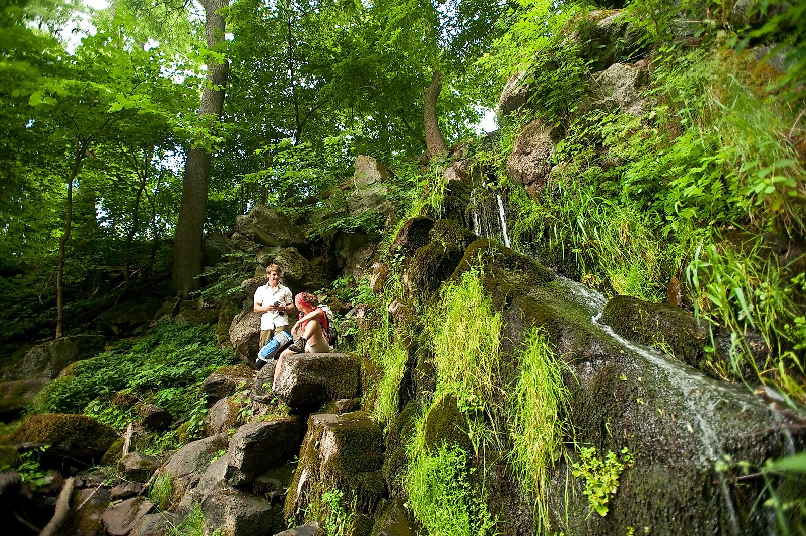
To the Tour PlanerStarting from Herborn, the path leads us past the villages of Merkenbach and Fleisbach up to Greifenstein. There we can see the landscape-dominating high castle in a spectacular location with its unique silhouette. From Greifenstein we pass the castle ruins of Lichtenstein to the beautifully situated Ulmbachtalsperre, which invites you to take a bath in summer. The next stage we reach in the mountain forest above Nenderoth a scenic speciality, because here you can find the Nenderoth waterfall. A big name for the small Leyenbach, which falls over some rocks here. However, when the water level is good - especially in spring and autumn - the waterfall forms a picturesque backdrop. The last stage of the Greifenstein loop leads us past the Krombachtalsperre and back to the Westerwald-Steig near Rehe. From here you can continue the route as a circular hiking trail in the direction of Fuchskaute to the starting point in Herborn.
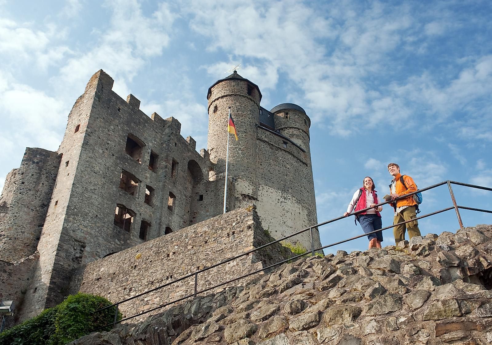
The Wäller Tour "Greifenstein-Schleife" leads from Herborn in Hessen to deer and offers numerous highlights. Worth seeing is the eponymous Greifenstein Castle.
From the south or north: via the A45 to exit 27 Herborn-Süd in the direction of Herborn/Gladenbach/Sinn/Greifenstein
From east or west: via the B255 towards Herborn
Bus/train to Herborn (Hessen) ZOB, continue with line 502 to stop "Wellenbad",
Footpath to the estate approx. 350 m (www.vld-wetzlar.de)
Free of charge: Gasthaus Brauerei & Hotel Gutshof, Im Gutshof 1, 35745 Herborn
Starting from Herborn, the path leads us past the villages of Merkenbach and Fleisbach up to Greifenstein. There we can see the landscape-dominating high castle in a spectacular location with its unique silhouette. Greifenstein Castle is the landmark of the region, visible from afar. Here, the world of bells Burg Greifenstein with almost 50 bells invites us to an informative walk through a thousand years of German bell history. Friends and connoisseurs of sacral architecture will also get their money's worth at Greifenstein Castle, because one of the few double churches in Germany is located on the castle grounds.
From Greifenstein we pass the castle ruins of Lichtenstein to the beautifully situated Ulmbachtalsperre, which invites for a swim in summer. In the further course the Greifenstein loop leads us up to Rodenroth. Behind the village we cross the Rasenberg, from where, in good weather, you can enjoy a great view as far as the Feldberg im Taunus.
The next stage we reach in the mountain forest above Nenderoth a scenic speciality, because here you can find the Nenderoth waterfall. A big name for the little Leyenbach, which is falling over some rocks here. However, when the water level is good - especially in spring and autumn - the waterfall forms a picturesque backdrop. In winter, the Nenderother Waterfall transforms into a natural ice sculpture during longer periods of frost.
Following the path further on, we reach the Hahrehausen landscape conservation area above Arborn, where we find the Adolf Weiss monument. The local poet Adolf Weiss was the creator of the Westerwald greeting "Hui!" "Wäller? "Allemol!". The last stage of the Greifenstein loop leads us past the Krombachtalsperre back to the WesterwaldSteig near Rehe. From here you can continue the route as a circular hiking trail in the direction of Fuchskaute to the starting point in Herborn.
hiking bootsWeather-adapted,
functional clothing
Visit the Greifenstein Castle with its famous world of bells. You can reach the castle via a marked access path. The entrance fee is 4,00 €.
Hiking map-Leporello Wäller Touren, GPS-accurate hiking map with excursion destinations, refreshment & leisure tips, street names and elevation profiles, map size (W x H): 20 map pages à 18 x 20 cm, 9 red. Pages, 6,95 € - You can get the hiking map and the hiking book in the Westerwald-Shop at www.westerwald-shop.info!
Herborn, Gasthaus Brauerei & Hotel Gutshof, Im Gutshof
Herborn, Gasthaus Brauerei & Hotel Gutshof, Im Gutshof
More information & GPX download
Notice
In the tour planner we inform you under the tab "Current info" about temporary route changes, closures and detours.
To the Tour Planer