Hiking Trail
Route profile
Notice
In the tour planner we inform you under the tab "Current info" about temporary route changes, closures and detours.
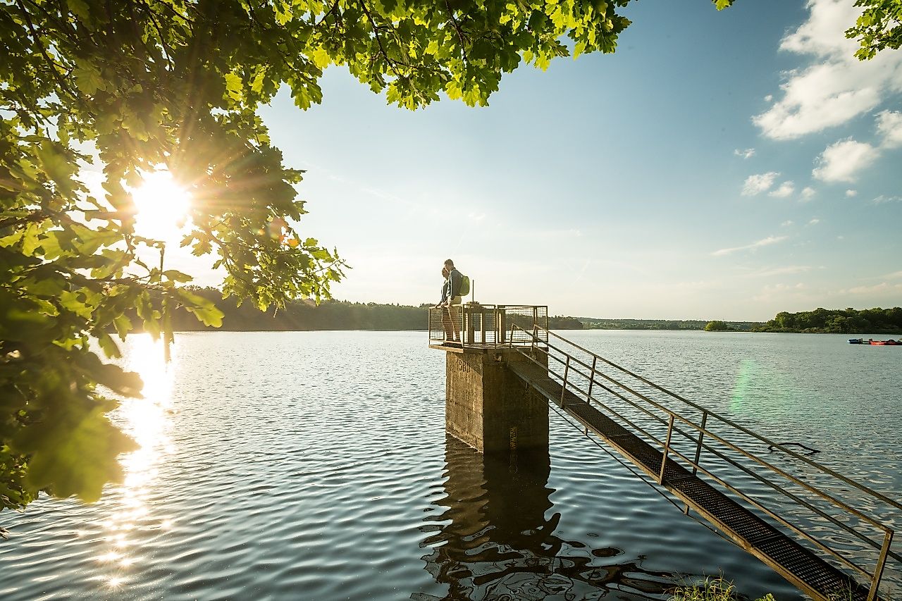
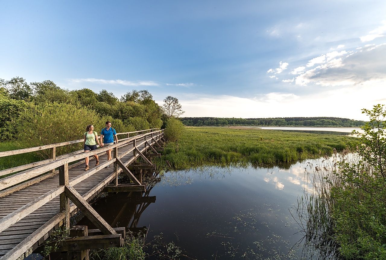
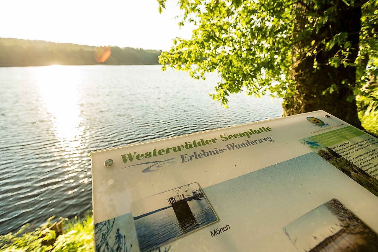
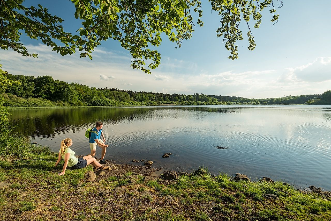
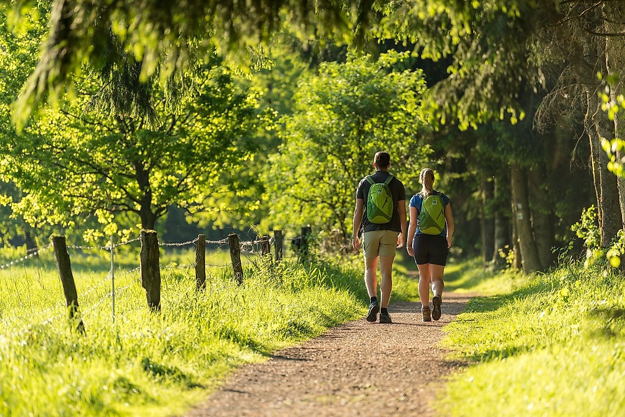
To the Tour PlanerThe way is not specially signposted. You can follow the signs for the 7-Weiher-Wanderweg Nordschleife, where you can discover the kingdom of the great crested grebes, gray herons and coots. The Dreifelder Weiher, with its shallow water zones, swamp areas and moist grassland areas, offers a habitat for rare plants and animal species, which can be observed from the bank trail. There are no inclines, the paths are gravel and can be walked on in any season. Several display boards explain a lot of interesting facts about the geology, flora, fauna, the country and the people. The highlights of this circular hiking trail close to the shore are the wooden high seat and the bridge in Dreifelden, which offer wonderful views over the lake and the river Wied.
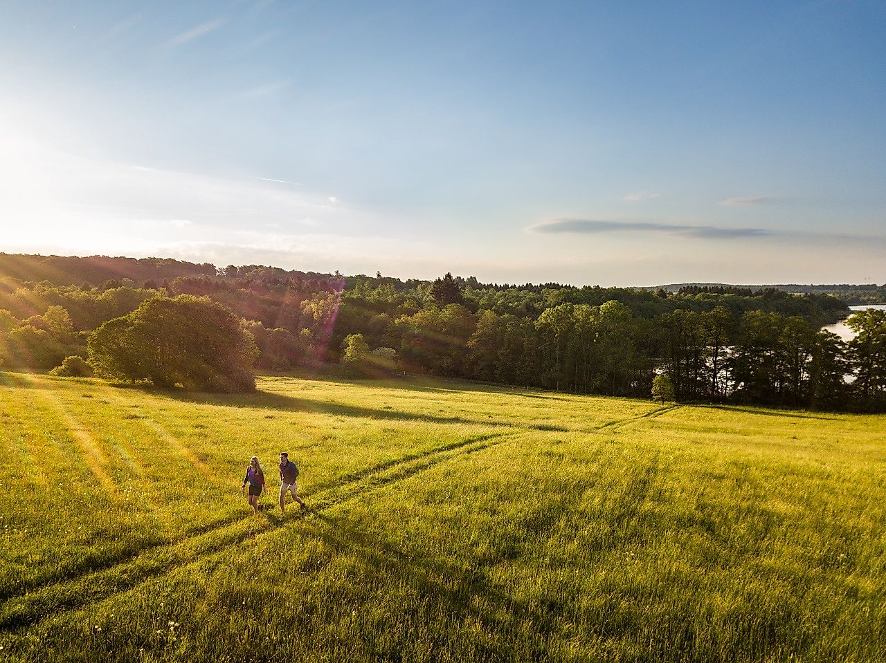
At an altitude of more than 400 m, the Dreifelder Weiher, with 123 hectares the largest pond in the Westerwald lake district, blends picturesquely into the lovely hilly high plateau landscape.
From Hachenburg (north): We leave Hachenburg via Steinebacher Straße. At the end of the village we follow the L292 to Steinebach. In Steinebach we follow Mittelstrasse to the end of the village in the direction of Schmidthahn. In Schmidthahn we follow Weiherstraße and turn right outside of the village onto the K1 in the direction of Seeburg. A few meters further on, on the right-hand side, there is a parking lot opposite the "Haus am See" campsite.
From Selters (southwest): We drive on the L304 to Freilingen. In Freilingen we turn left into Hohe Straße. After Freilingen we turn right onto the L303, which we follow for about 2.5 kilometers, until we turn left onto the K1 and a short time later turn right to continue on the K1 for about 2.3 km to the parking lot ( left side) opposite the camping site "Haus am See".
From Westerburg (east): We leave Westerburg via Langenhahner Straße and turn right at the end of the street into the L288. We follow this street to Rotenhain, where we turn left into Bahnhofstraße. At the crossroads for we turn right onto the main road which turns into the K8. We follow this to Lochum. In Lochum we turn left into Alte Poststrasse and follow this to the exit from the village, where we continue on the L303 via Linden to Dreifelden. In Dreifelden we turn right at the first intersection into Kirchstrasse in the direction of Schmidthahn. We continue on the K2 and after approx. 1.9 km turn left onto the K1. After approx. 300 m we reach the parking lot on the right-hand side opposite the "Haus am See" campsite.
With the bus line 433 from Hachenburg to Kr.Seeburg, Steinebach an der Wied or Dreifelden. The hike can start and end at these points.
Taxi company:
Taxi Schmidt: Hachenburg, Tel .: 02662/6119 or 02662/6688
Taxi Uwe Bischoff: Hachenburg, Tel.: 02662/944444
Taxi Kappi-Tullius: Hachenburg, Tel.: 02662/939390
Taxi Hetzler: Selters, Tel.: 02626/6445
Steinebach an der Wied: Free car park opposite the Haus am See campsite, Steinebacher Straße 1, 57629 Steinebach an der Wied
Free parking at the Seeburg cemetery, Steinebacher Straße, 57629 Steinebach an der Wied
Dreifelden: Free parking at the golf course in Dreifelden, Steinebacher Straße, 57629 Dreifelden
Free parking lot at the entrance of Dreifelden, Steinebacher Straße, 57629 Dreifelden (opposite the parking lot of the golf course there is a street leading to the parking lot)
Steinen: Free parking space at the Steinen adventure playground
We start our hike from the parking lot of the camping car park "Haus am See" to the left and walk along the shore of the Dreifelder Weiher. After approx. 1.5 km we leave the bank and hike across meadows to Dreifelden. From there the path leads us through fairytale forests until we discover the Haidenweiher on the left. After approx. 500 m we reach our starting point at the "Haus am See" car park. There are no inclines and the circular hiking trail is therefore also very suitable for inexperienced hikers.
We take enough time for the numerous display boards along the way to learn more about the region.
Topographic map 1: 25000 Ferienland Westerwald sheet 1, ISBN 978-3-89637-253-6
Camping site "Haus am See", Seeburger Strasse 1, 57629 Steinebach an der Wied
Camping site "Haus am See", Seeburger Strasse 1, 57629 Steinebach an der Wied
More information & GPX download
Notice
In the tour planner we inform you under the tab "Current info" about temporary route changes, closures and detours.
To the Tour Planer