Hiking Trail
Route profile
Notice
In the tour planner we inform you under the tab "Current info" about temporary route changes, closures and detours.
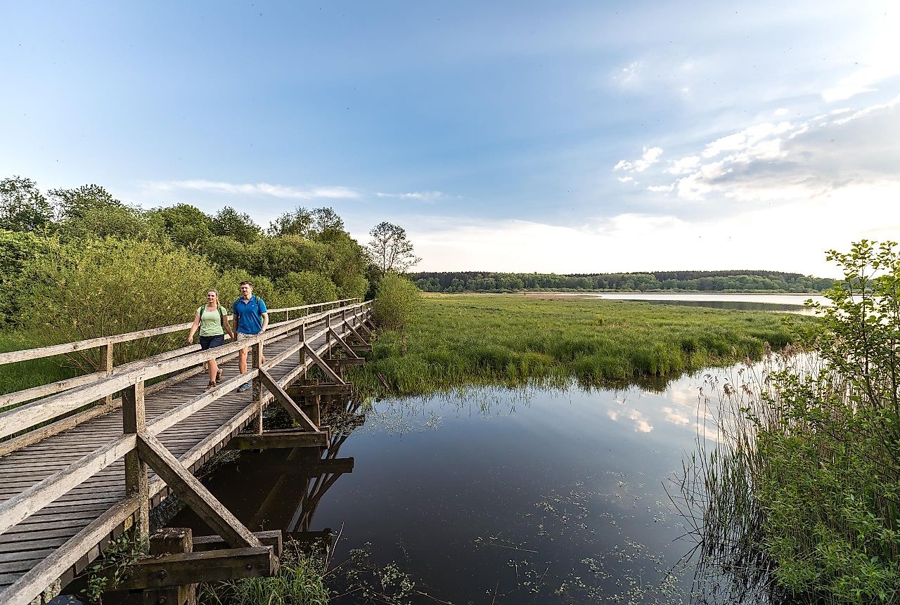
To the Tour PlanerThe source of the Wied springs from beneath the roots of a centuries-old beech tree. From there, you start and follow the Wied towards Dreifelden, where you can marvel at the oldest stone church in the Westerwald, the Dreifaltigkeitskirche. On the banks of the Dreifelder Weiher, the largest body of water in the Westerwald lake district, take a break on one of the benches, relax and enjoy the breathtaking scenery. You follow the Wiedweg and leave the Dreifelder Weiher nature reserve in the direction of Oberes Wiedtal, where you come across the Steinebach/Wied sculpture park. With its cultural and historical symbols, the characteristics of the landscape have been visualised in the form of five "sculptures along the path and stream". The Upper Wiedtal nature reserve with its floodplain landscapes, wet meadows and biotopes is home to many plant and animal species. You accompany the Wied to the village of Höchstenbach, where your 1st stage of the Wiedweg ends.
Where the Wied has its origin and endangered birds find shelter
By car via A3 to exit Montabaur, via B255 and B8 to Freilingen and L303 to Linden.
Train from Cologne to Hachenburg station, continue with VRM bus line 433 to Linden (Westerwald)
Train from direction Limburg to train station Hachenburg, continue with VRM bus line 433 to Linden (Westerwald)
Return from gas station, Höchstenbach to Linden (Westerwald): VRM bus line 115 or bus line 415 to Markt, Hachenburg and continue with VRM bus line 433 to Linden (Westerwald).
www.bahn.de | www.vrm.info
Cab company:
Cab Schmidt GbR: Hachenburg, Tel.: 02662/6119 or 02662/6688
Cab Uwe Bischof: Hachenburg, Tel.: 02662/944444
Cab Kappi-Tullius: Hachenburg, Tel.: 02662/939390
Hehn-Touristik: Alpenrod, Tel.: 02662/3366
Cab Hilgers: Bad Marienberg, Tel.: 02661/5055
Cab company Kevin Nagel: Bad Marienberg, Tel.: 02661/5949
Cab Uwe Bischoff: Altenkirchen, Tel.: 02681/2222
Cab Uwe Bischoff: Wissen, Tel.: 02742/1055
Taxi-Mietwagen Jaung, Reinhold: Hamm/Sieg, Tel.: 02682/8555
Linden: free parking at the village community center, Waldstraße 11, 57629 Linden (approx. 600 m to the Wiedquelle)
Note: no parking directly at the Wiedquelle/start point!
Höchstenbach: free parking at the cemetery, Friedhofstraße 57629 Höchstenbach
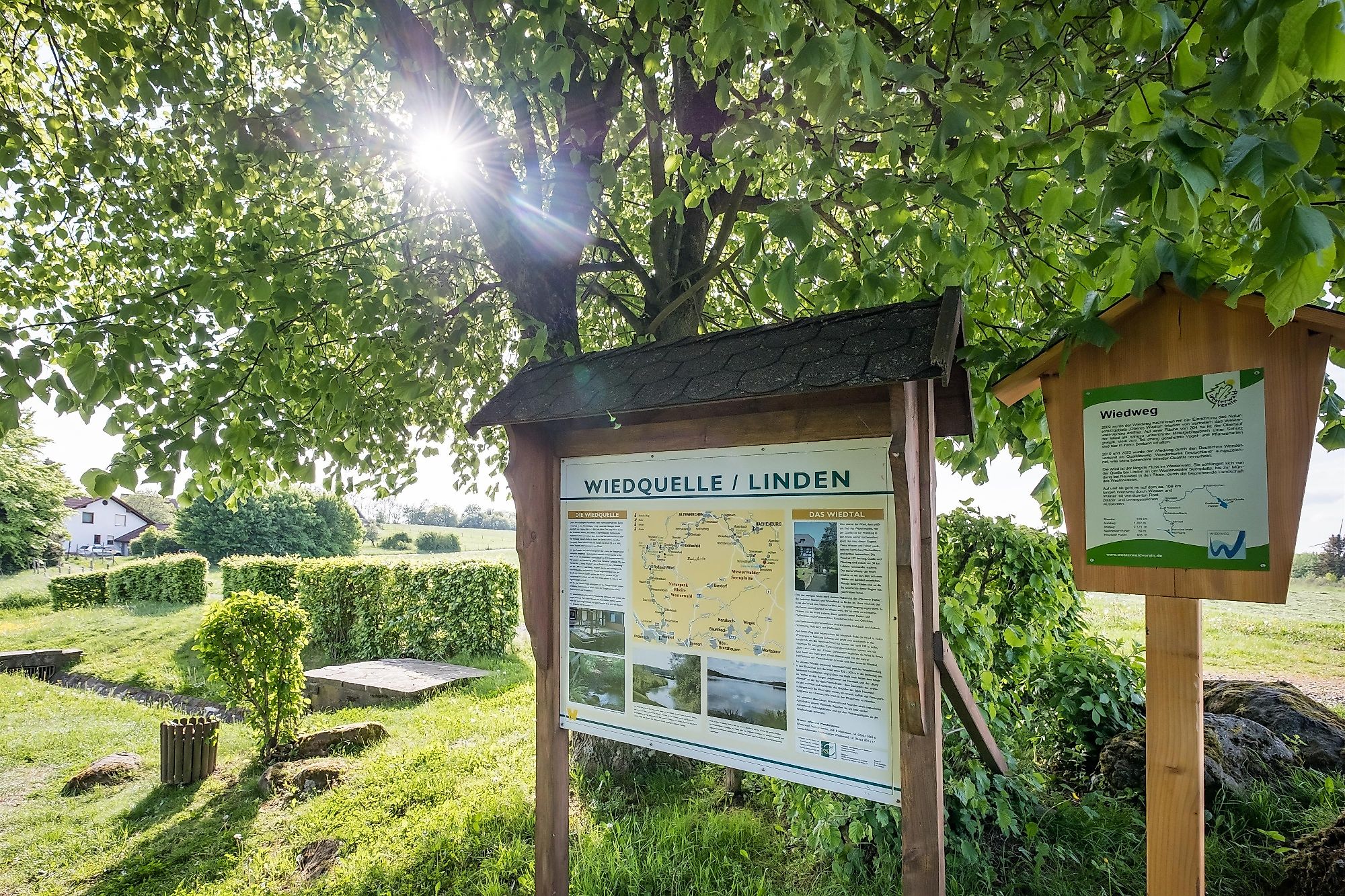
You start the second stage of the Wied Trail at the source of its namesake, the Wied, in Linden. The Wied spring, set in natural stone, lies under the roots of a beech tree that is several hundred years old. Before you set off on your hike, check out the information board for the exact location and the surrounding area.
Cross the L303 and follow the Wiedweg for around 600 metres on a nature trail before turning right after 200 metres. After a short stretch on a gravel path, turn left onto a path that crosses the forest road after around 300 metres and continues straight ahead for around 400 metres to Trift Straße. Continue along the path on the other side for 800 metres, leaving the Dreifelden cemetery on your right and then turn right onto a gravel path. After a few metres, keep right again and follow the Wiedweg for 500 metres to Dreifelden. At Wiedbachstraße, take a detour to the right to the Dreifaltigkeitskirche church. Then go back and follow the road around a right-hand bend before turning right onto a nature trail. After around 100 metres, turn left, then shortly afterwards right and approach the Dreifelder Weiher pond.
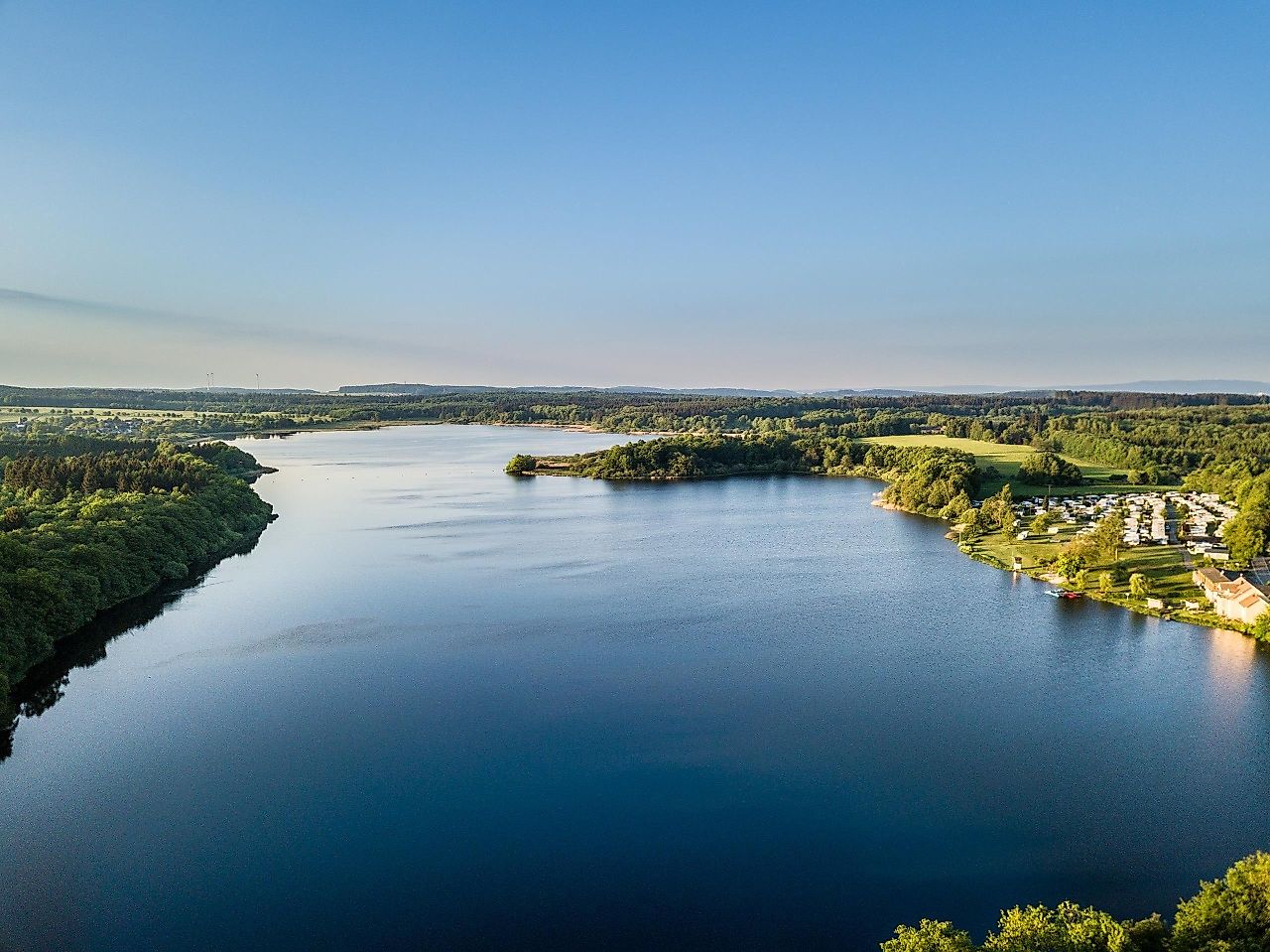
Follow the path, cross a small bridge and turn left after 200 metres to follow the pond for 2.4 kilometres parallel to the shore and finally to the other side of the lake to the Haus am See campsite. You can enjoy the view of the water and enjoy a refreshment before turning right onto a gravel path, which leads into a natural path after 200 metres. Follow this for around 400 metres to the shore of the Hofmannsweiher pond and another 1.1 kilometres further on. Then turn left onto a 500 metre long gravel path and take a sharp right onto a nature trail.
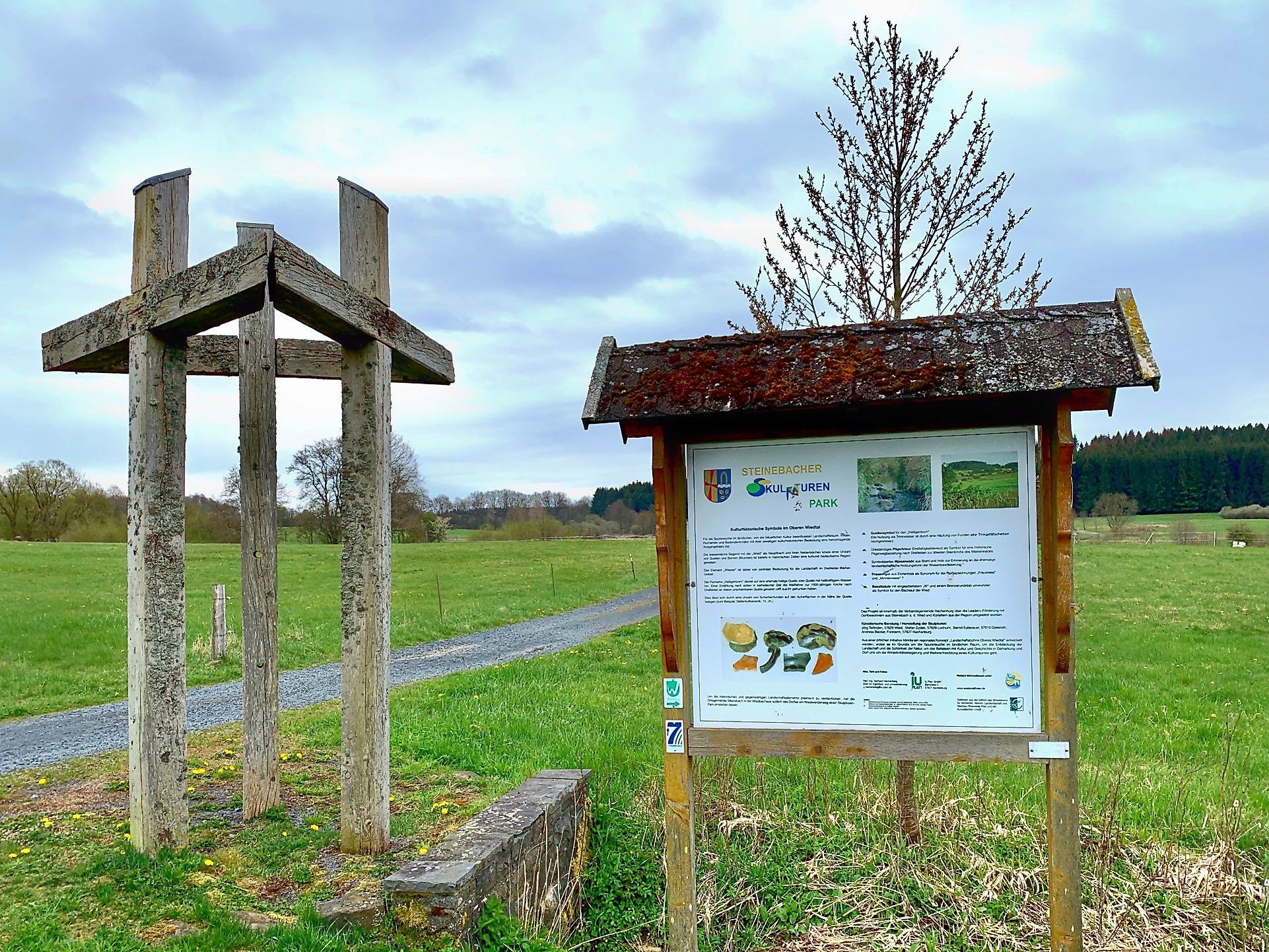
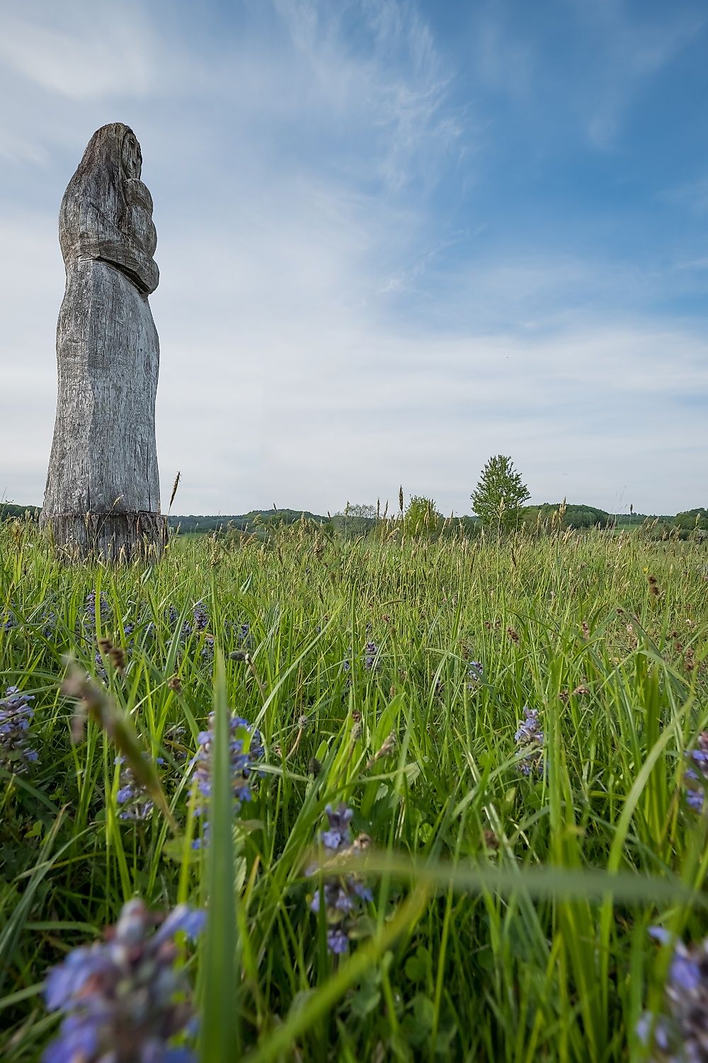
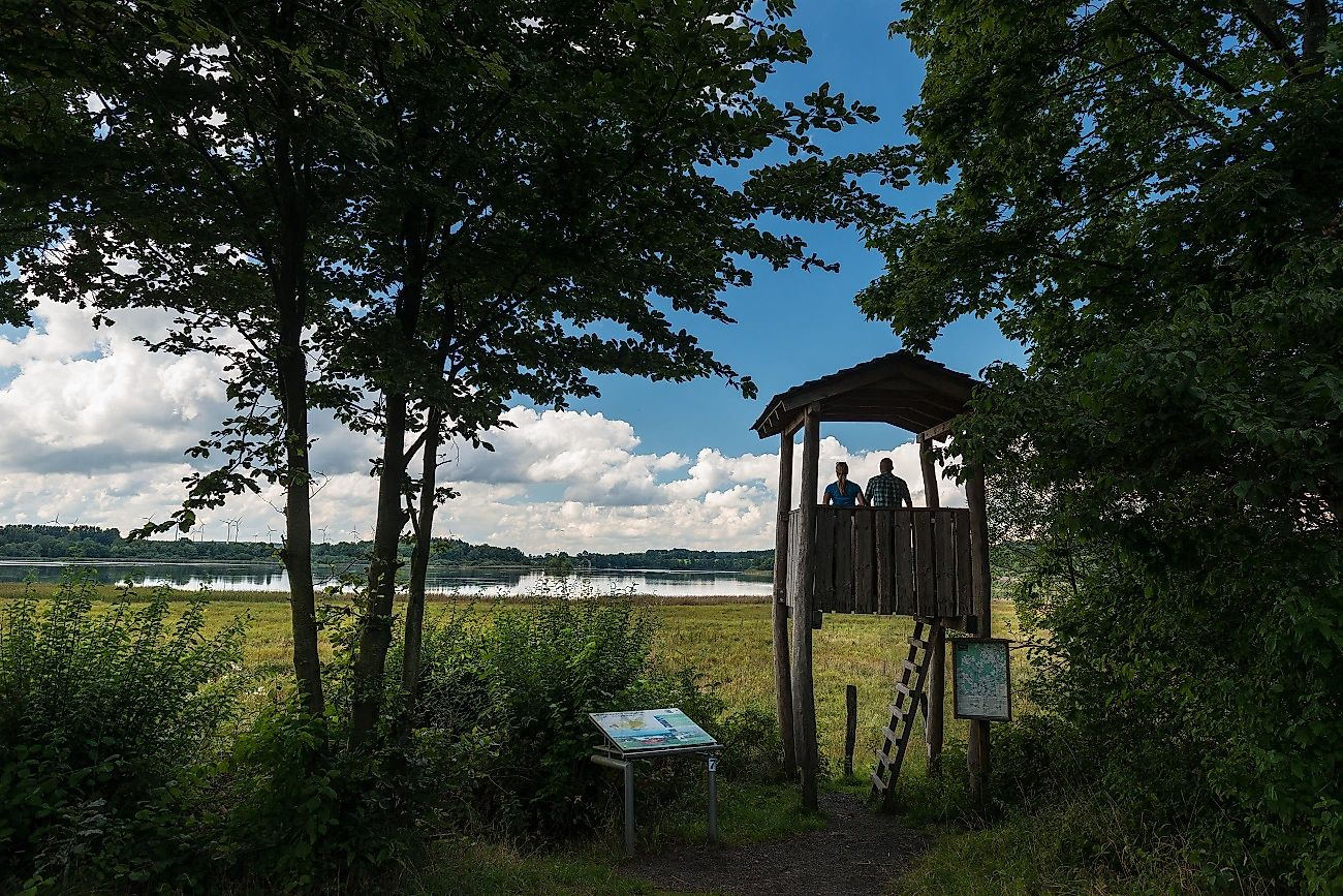
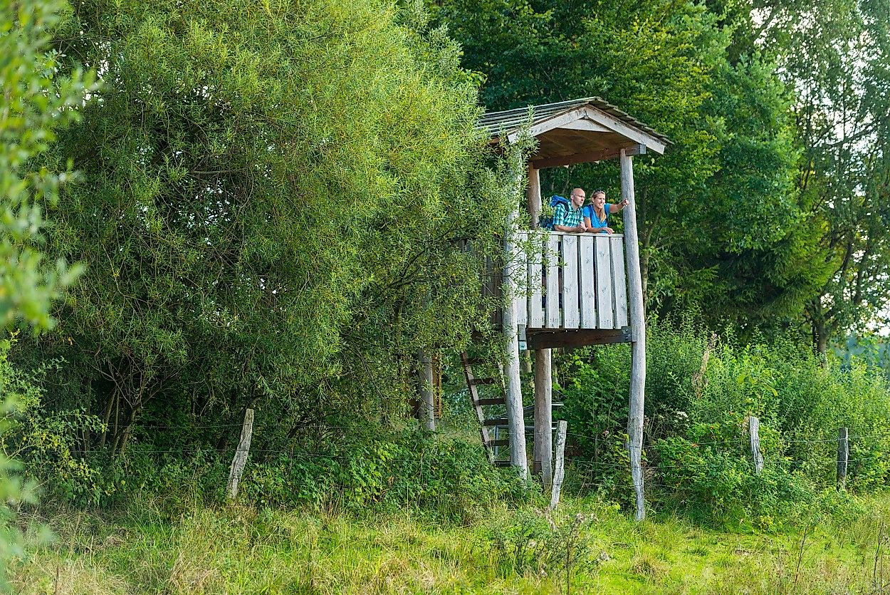
After 800 metres, you will reach the Steinebach an der Wied sculpture park. An information board introduces you to the cultural and historical symbols in the Upper Wiedtal and you can admire the basalt column, a female figure made of oak wood, the meadow weir made of steel and wood and the spring symbol for the "Heiligenborn". Then you walk on towards Steinebach an der Wied. After around 900 metres, you are in the middle of the village and cross Hachenburger Straße. You cross the Steinebach and come to the Mühlenweg. Follow this to the right until you reach Wiedstraße and turn left. Then walk almost straight ahead for around six kilometres through the Oberes Wiedtal nature reserve in the direction of Höchstenbach to the end point at Born's Imbiss.
Sturdy shoes recommended!
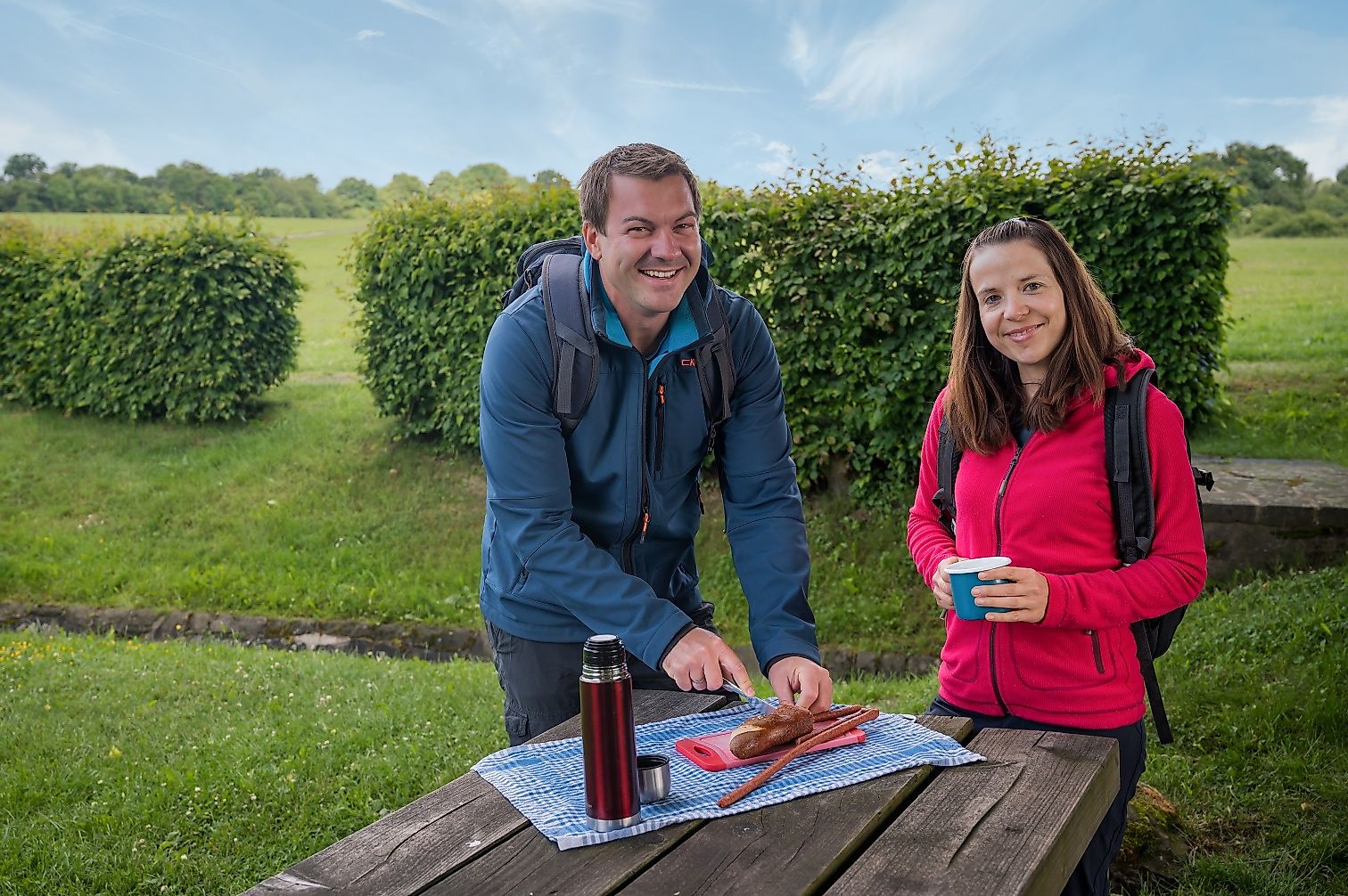
Enjoy a great view of the Dreifelder Weiher at one of the benches.
Born's Imbiss, Koblenzer Straße, 57629 Höchstenbach
Wiedquelle at the L303 in 57629 Linden
More information & GPX download
Notice
In the tour planner we inform you under the tab "Current info" about temporary route changes, closures and detours.
To the Tour Planer